Home > All the maps > Ga GLIS

Lets go to the beach!

Our Atlanta Beach House

Home

Maps
  GA GLIS

Places

Departments

Lets eat!

Us


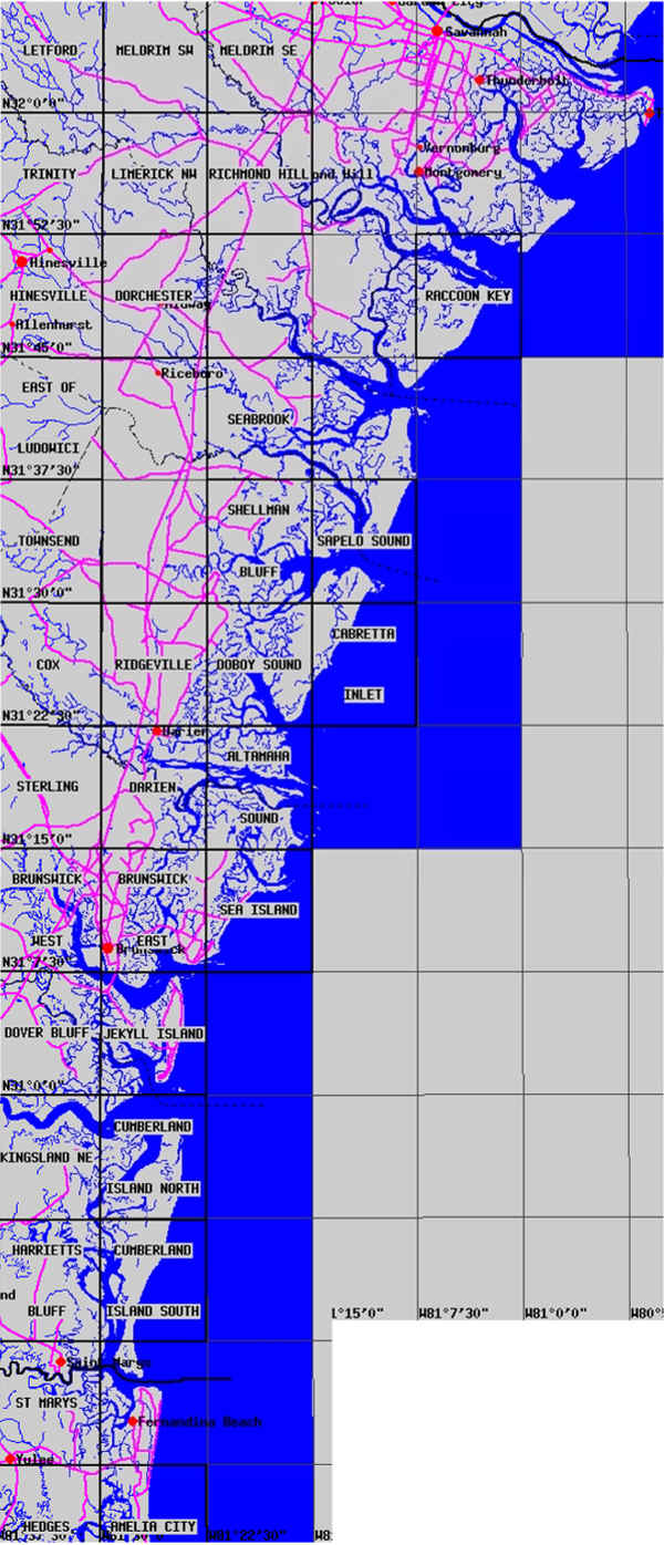
Georgia GLIS maps are a USGS gateway for ordering maps (9-19-00)

We tried to make a detailed map of the coastline of a whole state.  There are links to the original sources.


From Tybee Island, Georgia to St. Mary's, Georgia

Tybee Island to Raccoon Key
Raccoon Key to Cabretta
Sapelo Island to Altamaha
Altamaha to Jeykyll Island
Sea Island to Cumberland Island
Cumberland Island to Amelia Island, (Florida)

High Quality Maps by the USGS

This is a crude approximation but shows the whole Georgia Coast:


Home  |  Beach Maps  |  Aerial & Topo Maps  |  Bridge Maps  |

Piers  |  Big Boats  |  Lighthouses  |  Atlanta Beaches  |  Map Sources  |

Hall of Fame  |  Books  |  Beach Media  |  Links  |  CORPS Aerials  |

Been There  |  Us  | Log  |  SC GLIS Maps  Ga GLIS Maps  |  Fla Atlantic GLIS Maps  |

Forum/Q&A  |  Beach Site Catalogue  | 


  |