Home > All the maps > Fla GLIS

Lets go to the beach!

Our Atlanta Beach House

Home

Maps
  FL Atl. GLIS

Places

Departments

Lets eat!

Us


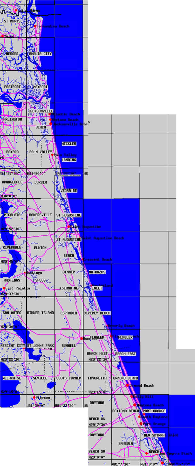
Florida Atlantic GLIS maps are a USGS gateway for ordering maps (9-19-00)

We tried to make a detailed map of the coastline of a whole state.  There are links to the original sources.


From Fernandia Beach, Florida to New Smyrna Beach, Florida

St. Mary's to Jacksonville
Mayport to Palm Valley
Neptune Beach to St. Augustine
Ponte Vedre to Marineland
St. Augustine to Flagler Beach
Beverly Beach to Holly Hill
Ormond Beach to New Smyrna Beach

High Quality Maps by the USGS

Another approximation but cover from the Georgia state line to New Smyrna Beach


Home  |  Beach Maps  |  Aerial & Topo Maps  |  Bridge Maps  |

Piers  |  Big Boats  |  Lighthouses  |  Atlanta Beaches  |  Map Sources  |

Hall of Fame  |  Books  |  Beach Media  |  Links  |  CORPS Aerials  |

Been There  |  Us  | Log  |  SC GLIS Maps  Ga GLIS Maps  |  Fla Atlantic GLIS Maps  |

Forum/Q&A  |  Beach Site Catalogue  | 


  |